"We judged that three nights more would fetch us to Cairo, at the bottom of Illinois, where the Ohio River comes in, and that was what we were after. We would sell the raft and get on a steamboat and go way up the Ohio amongst the free states, and then be out of trouble."
-Adventures of Huckleberry Finn
A solid plan -- and one that would lead to a much different book. But, Huck and Finn missed Cairo in the fog, which they realized when they saw "the clear Ohio water inshore, and outside was the old regular Muddy!" No choice but to head further south and take their chances.
For me, only two more nights to fetch me to Cairo. A place I had always wanted to see. But first ... a trip through New France.
It's easy to forget, but it was the French that were the first Europeans to arrive in the upper Mississippi, territory that they colonized and settled for over a century before giving up control via the Louisiana Purchase in 1803. French place names are everywhere -- Prairie du Rocher (the word 'prairie' means meadow in French), Cape Girardeau, and of course Saint Louis and the dozens of 'Saint' towns in the river valleys.
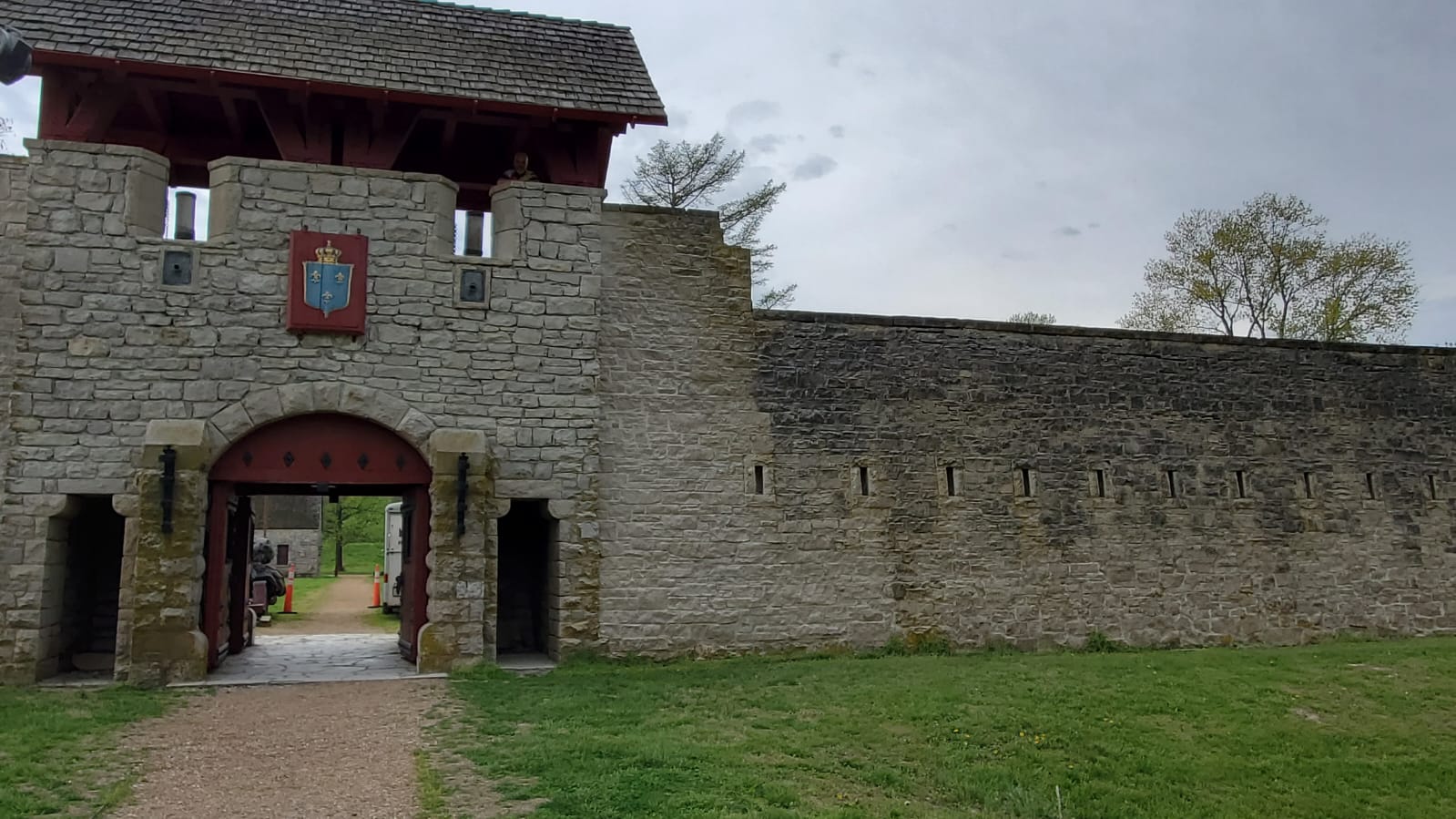
Fort de Chartres -- built by the French in the 1750s -- remains a very solid looking structure except for the side facing the river -- washed away in 1772 when the river changed channels. The French, unlike the English, focused more on trade than settlement. And so, in the end, their influence quickly disappeared because they didn't have enough people to leave a more permanent mark.
The trip was my first introduction to the river bottom land -- I rode over 30 miles on "Levee Road" -- the levee separating the farmland from the river -- seeing highly productive fields, a handful of tractors and pickup trucks, and literally no one or nothing else. No towns, no villages, no hamlets, just a few isolated farmhouses. It really brought home that in an age of mechanized agriculture, you don't need PEOPLE to farm. Meaning -- limited service jobs to support tiny #'s of farmers. Prairie du Rocher, pop. 500, was (as Sarah put it) "a sad little town" with one gas station, one general store and run-down houses -- the only such place for 50 miles. Easy to understand how those people feel little in common with America as we know it.
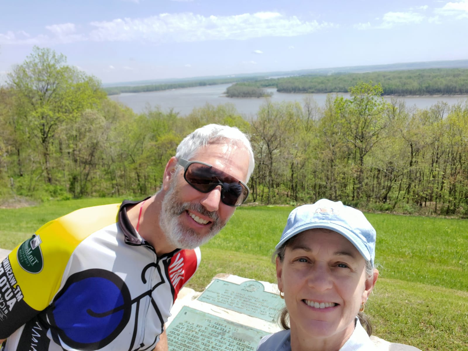
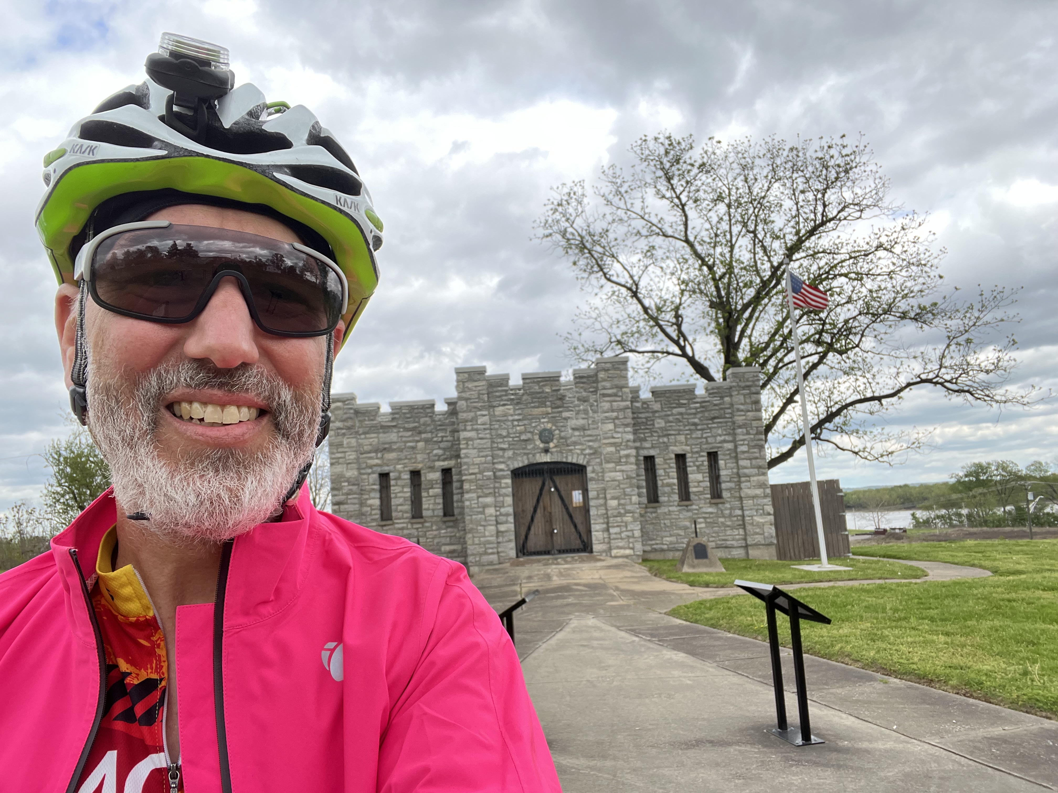
Kaskaskia was our next stop -- where American power first arrived to the region. Kaskaskia was the largest French settlement in the area -- nominally controlled by England after the French and Indian War. The American forces, led by George Rogers Clark (whose son co-led the Lewis and Clark exploration), surprised the British garrison and took control of the fort and the town in 1778, holding it for the remainder of the war (with support of the French settlers who had a shared enmity with England).
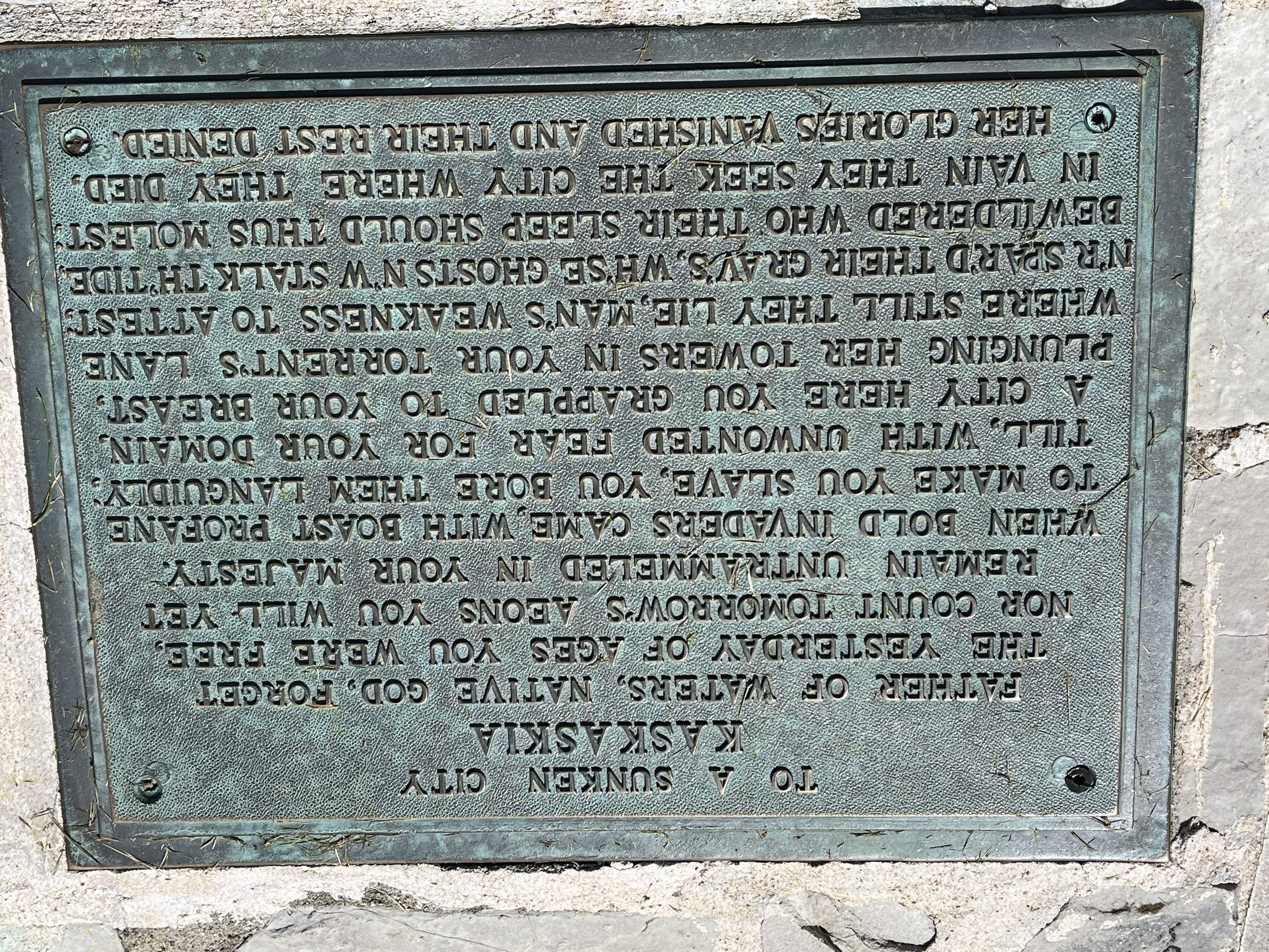
Kaskaskia became the territorial capital and first state capital of Illinois until -- the river had other plans. The town was built on a bend, or oxbow -- and the river cut through, flooding the town completely within a couple of years, forcing its abandonment. We enjoyed our tour of the fort site (built on the bluff above the river) -- it is very weird to look out on the wooded floodplain and know that thousands of people lived there. Reminded me of Quabbin. There is a long eulogy to the lost town in bronze markers, I've included a sample in the photos. Because the state lines were already fixed, the lost town of Kaskaskia remains part of Illinois, even though it now lies on the Missouri side of the river.
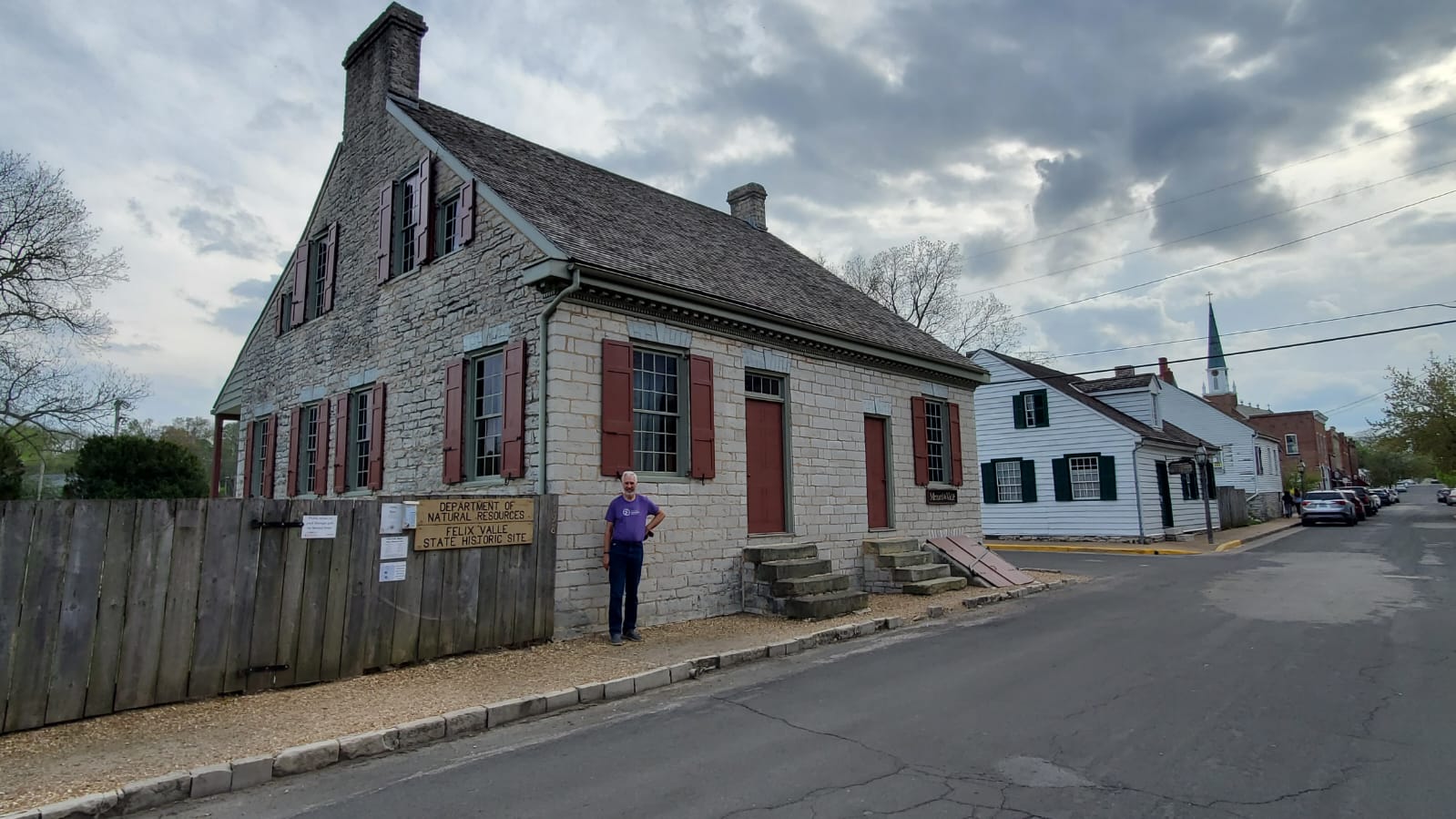
We had dinner in Ste. Genevieve, now preserved by the National Park Service, which has a collection of distinctively styled French colonial era buildings, including a magnificent and still active Catholic church. Well worth the visit.
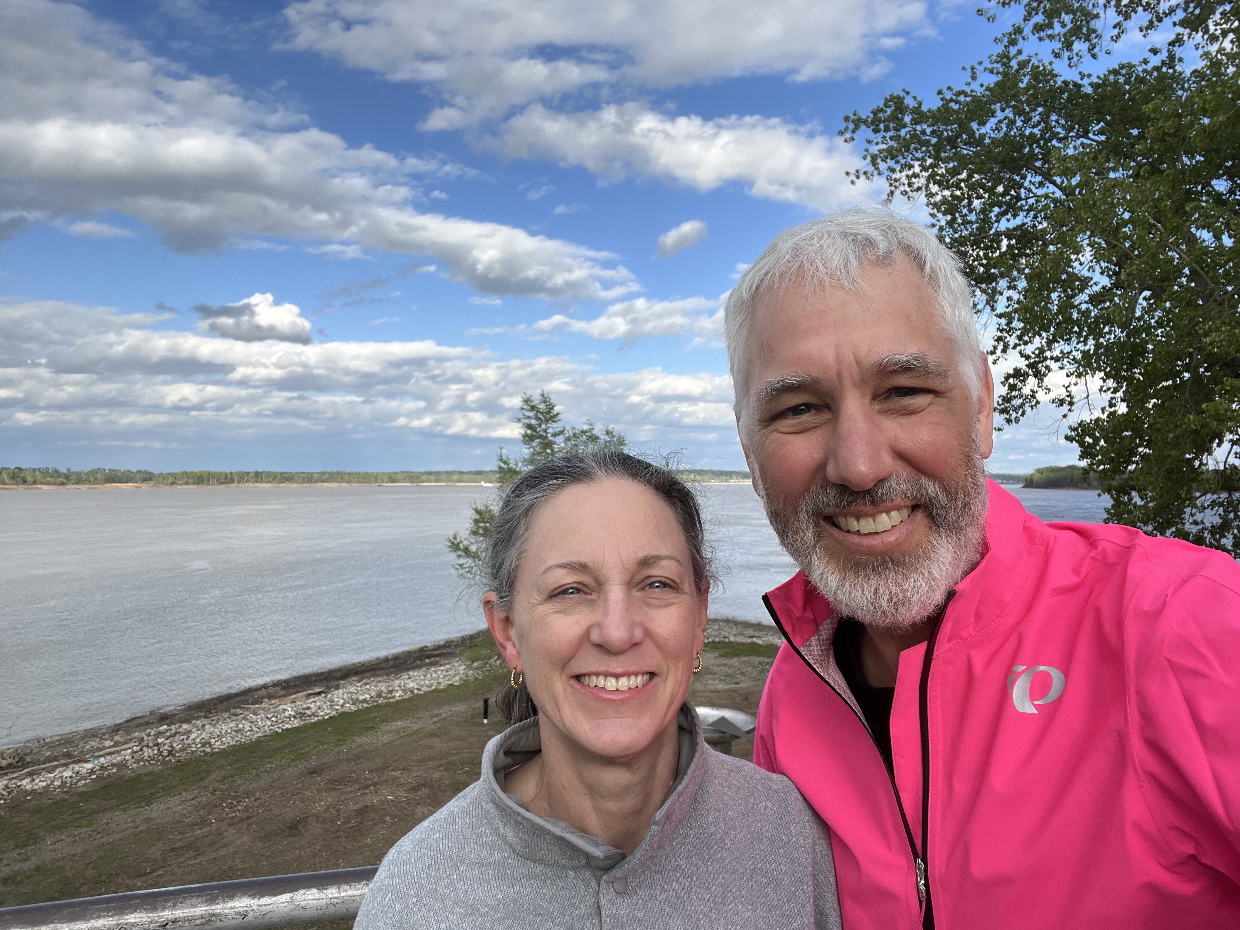
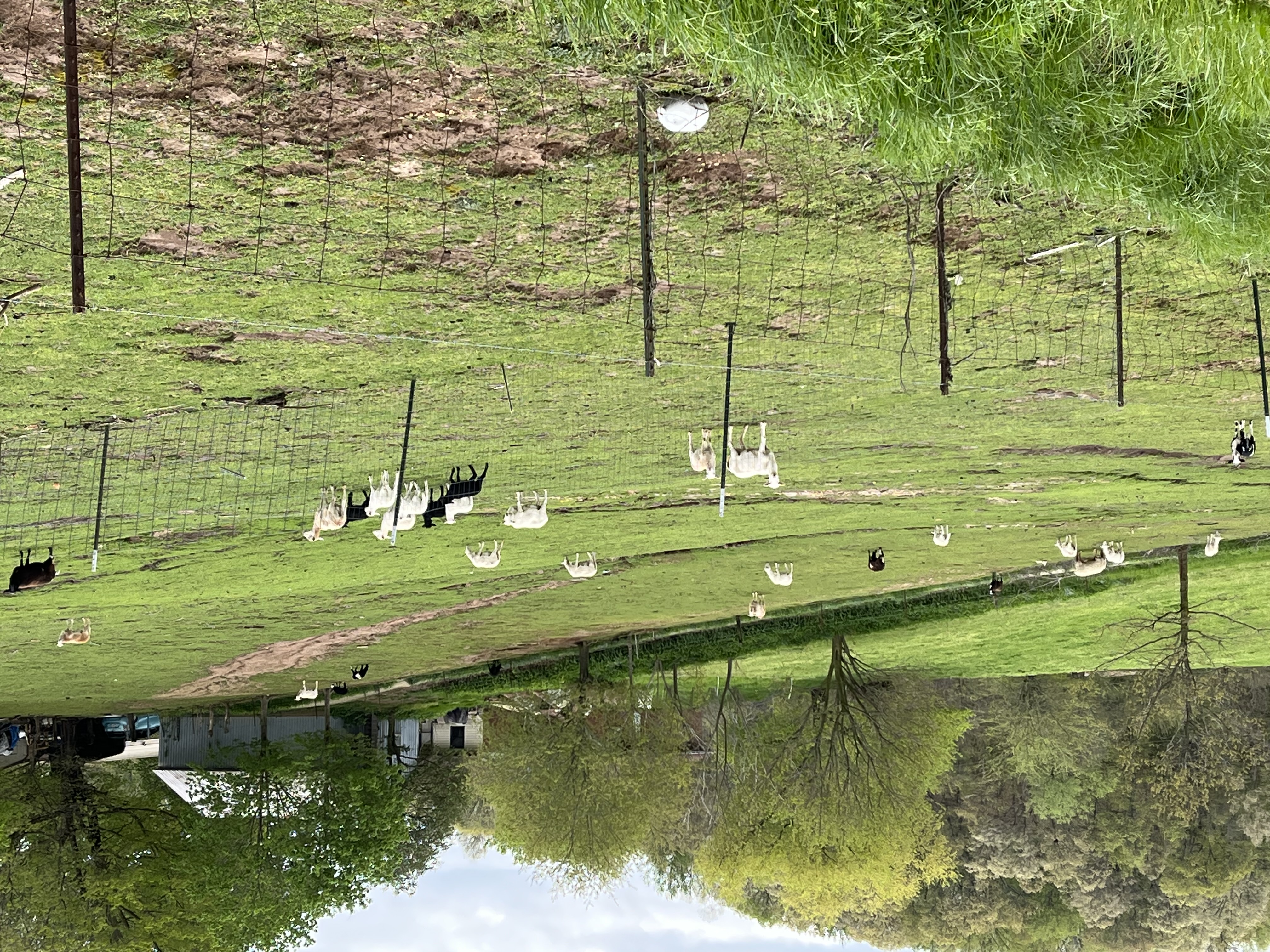
Today - Cairo (rhymes with 'arrow'). A place I have always wanted to visit, the confluence of America's two greatest rivers, the Ohio and the Mississippi. But first, a long tour of SE Missouri farmland - pasture for grazing, completely different from the Illinois bottom country. I saw cattle (dairy and beef) and sheep. Animals require people to take care of them - and therefore there were farmhouses every few hundred yards and small towns. It felt far more sustainable and pleasant than the dehumanized row crops I saw yesterday.
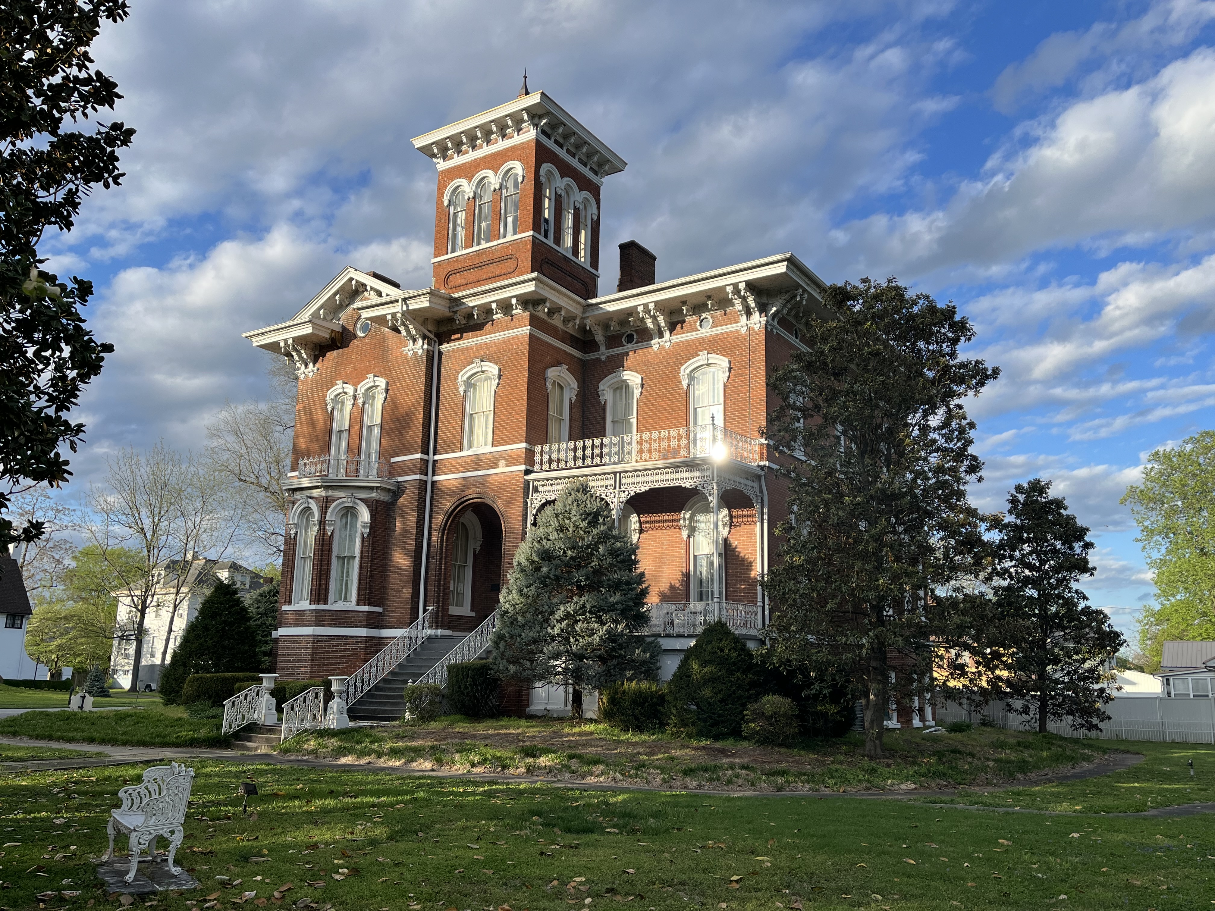
Cairo peaked in the 1860's, when it served as a supply base for Union troops heading south. We enjoyed seeing the handful of well-maintained mansions and houses from that period. The rest of the town - sad. Cairo, like Pittsburgh and Saint Louis, sits at the confluence of two great rivers. But recurring floods kept it from ever taking off as a great city.
We enjoyed our BBQ takeout from the observation deck overlooking the confluence - it was amazing to watch the skill of the barge pilot making the tight turn from one river to the other (see video). My only small disappointment - unlike Huck, there was no distinguishing the color of the Ohio from the Mississippi. It was still a treat to finally see it!
320 miles down, 440 to Vicksburg!